In recent years, wildfires in North America have intensified, with no signs of improvement. Climate change has exacerbated the severity of these fires, placing human lives, property, ecosystems, and wildlife at risk.
For over a decade, unmanned aerial vehicles (UAVs) have played a crucial role in wildfire suppression efforts. The Fire Apparatus Manufacturers’ Association predicts that by next year, the number of specialized UAVs deployed in firefighting operations will reach 30,000. However, despite their undeniable utility, these technologies still face significant limitations.
Andrew Jong, a PhD candidate at the Robotics Institute of Carnegie Mellon University (CMU), stated:
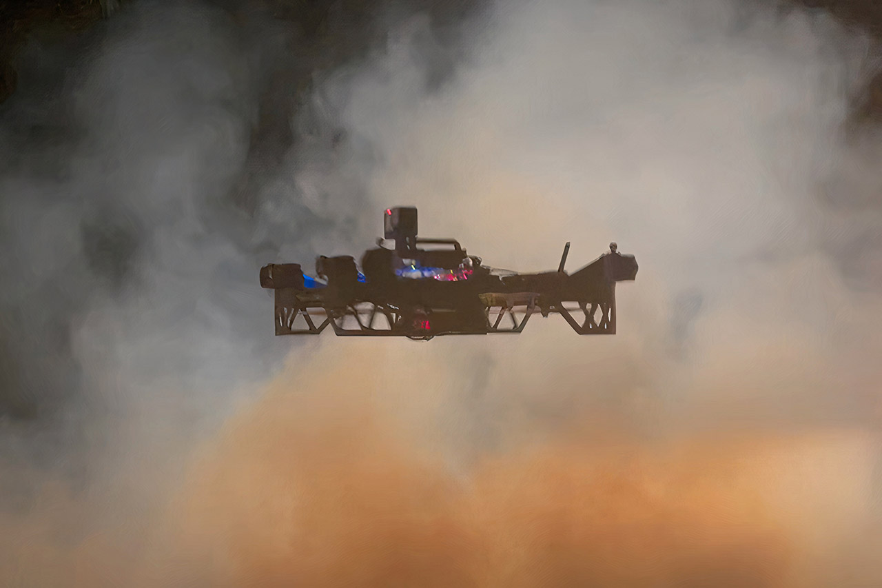
“Currently, military-grade UAVs used in wildfire suppression are typically unable to fly at low altitudes due to their inability to see through dense smoke layers. Our objective is to develop UAVs capable of flying just above the tree canopy or even navigating beneath it to assist in rescue operations.”
Low-Altitude UAVs: A Breakthrough in Wildfire Response
A research team at CMU’s Robotics Institute is developing UAVs designed to operate within the fire zone itself, facilitating real-time mapping, identifying evacuation routes, and warning firefighters of potential hazards.
Josh Wilkins, a former firefighter now collaborating with the research team, expressed his deep concerns:
“I have lost too many colleagues simply because they lacked timely information to protect themselves.”
He emphasized that firefighters often rely on outdated data—sometimes as much as 12 hours old—before embarking on their grueling 8 to 12 hour shifts. This significantly increases their risk when confronting wildfires.
This project builds upon CMU’s research under the DARPA Subterranean Challenge, an initiative focused on navigation in underground environments for rescue operations. The low-altitude UAVs are equipped with advanced pathfinding algorithms, enabling them to determine optimal trajectories even in obscured visibility conditions. The primary objective is to generate a real-time 3D digital twin of the affected area, providing firefighters with highly accurate and visualized data.
Challenges in Adopting Emerging Technologies
Despite the promising potential of low-altitude UAVs, Wilkins noted that persuading firefighting units to embrace this technology remains a formidable challenge:
“The firefighting sector has always been cautious when it comes to adopting new technologies. However, once we demonstrate that safety features are fully integrated into the system and highlight the invaluable data UAVs can provide, I am confident that their perception will shift.”
With their ability to deliver real-time intelligence, enhance search-and-rescue missions, and improve firefighter safety, low-altitude UAVs are poised to become indispensable tools in future wildfire response efforts.
Cre: TechCrunch